
690990688
geograf.biuro@gmail.comSzanowni klienci, w trakcie zakupów prosimy o zwrócenie uwagi na czas realizacji zamówienia poszczególnego produktu, znajdujący sie pod ceną produktu.
Kategorie
Producenci


YOSEMITE NW 307 HETCH HETCHY RESERVOIR mapa wodoodporna 1:40 000 NATIONAL GEOGRAPHIC

| Producent: NATIONAL GEOGRAPHIC |
| Kod EAN: 9781566954129 |
")
")
")
")
")
")
YOSEMITE National Park
NW: Hetch Hetchy Reservoir
Składana mapa wodoodporna
NATIONAL GEOGRAPHIC
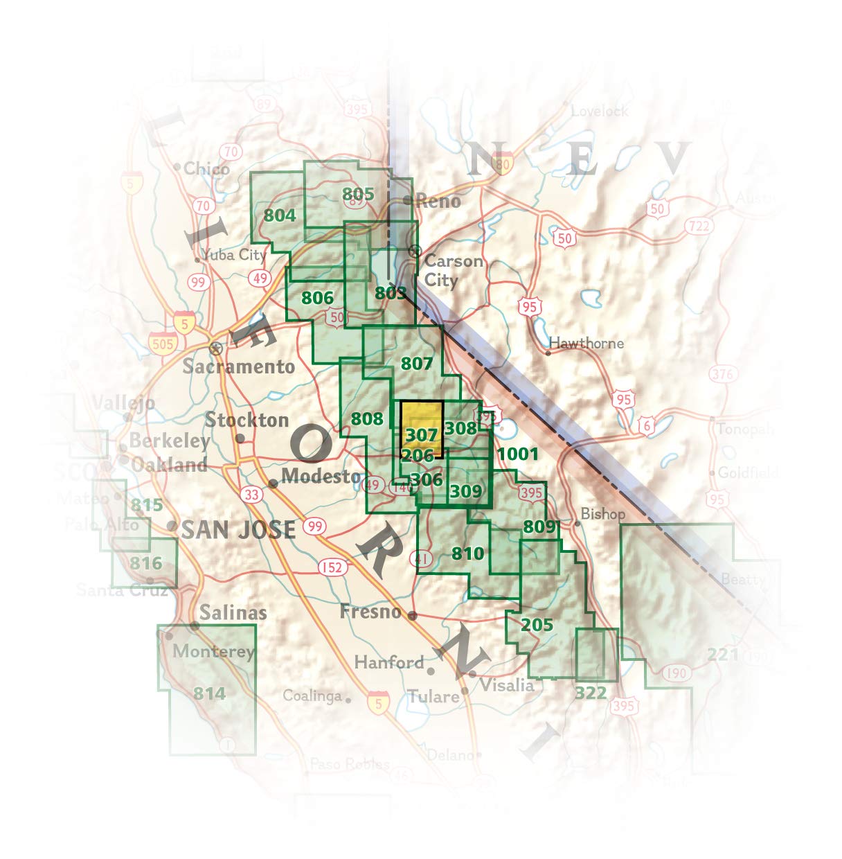
National Geographic's Trails Illustrated map of Yosemite NW: Hetch Hetchy Reservoir is designed to meet the needs of outdoor enthusiasts by combining valuable information with unmatched detail of this magnificent region of Yosemite National Park. Expertly researched and created in partnership with the National Park Service, U.S. Forest Service and others, the map's coverage extends from the park's northwestern border to the White Wolf area and features key points of interest of Yosemite Wilderness including Lake Eleanor, Grand Canyon of the Tuolumne River, Tilden Lake and Pate Valley as well as the Emigrant Wilderness in the neighboring Stanislaus National Forest.
Get off the beaten path and back again by following precisely mapped trails with mileage markers, including portions of the Pacific Crest and John Muir trails, which are both highlighted. To aid in your navigation of the region, the map includes contour lines, elevations, labeled peaks and summits, water features and selected waypoints. Some of the marked recreation features are campgrounds, campsites, fee stations and ski areas. Ranger stations are clearly marked as well. Also included are camping, hiking, wilderness permit, and safety information.
Every Trails Illustrated map is printed on "Backcountry Tough" waterproof, tear-resistant paper. A full UTM grid is printed on the map to aid with GPS navigation.
Other features found on this map include: Emigrant Wilderness, Lake Eleanor, Stanislaus National Forest, Yosemite National Park.

| Autor: | praca zbiorowa |
| Producent/Wydawnictwo: | National Geographic |
| Rok wydania: | 2019 |
| Kod kreskowy: | 9781566954129 |
| Skala mapy / planu miasta: | 1:40 000 |
| Język: | angielski |
| Wymiary: | 19 x 10 cm |
| Okładka / oprawa: | miękka wodoodporna |
| Numer części w serii: | 307 |
-
Promocja P

FLORYDA mapa samochodowa 1:800 000 MARCO POLO
FLORYDA mapa samochodowa 1:800 000 MARCO POLO19,90PLNStara cena 29,90Dodaj do koszykadodano produktprodukt niedostępny -
Nowość N Promocja PPolecany P

WIELKI KANION I ARIZONA mapa ITMB 2022
WIELKI KANION I ARIZONA mapa ITMB 202254,90PLNStara cena 59,90Dodaj do koszykadodano produktprodukt niedostępny -
Nowość N Promocja PPolecany P

KALIFORNIA mapa 1:850 000 REISE KNOW HOW 2023
KALIFORNIA mapa 1:850 000 REISE KNOW HOW 202349,90PLNStara cena 59,90Dodaj do koszykadodano produktprodukt niedostępny -
Promocja PPolecany P

KARAIBY - AMERYKA ŚRODKOWA - BAHAMY - WYSPY DZIEWICZE mapa KASPROWSKI
KARAIBY - AMERYKA ŚRODKOWA - BAHAMY - WYSPY DZIEWICZE mapa KASPROWSKI46,90PLNStara cena 54,90Dodaj do koszykadodano produktprodukt niedostępny -
Promocja PPolecany P

MANHATTAN 1:12 500 STAN NOWY JORK 1:1 000 000 mapa ITMB
MANHATTAN 1:12 500 STAN NOWY JORK 1:1 000 000 mapa ITMB54,90PLNStara cena 59,90Dodaj do koszykadodano produktprodukt niedostępny -
Nowość N Promocja PPolecany P

GUAM / ZACHODNI PACYFIK mapa ITMB 2022
GUAM / ZACHODNI PACYFIK mapa ITMB 202254,90PLNStara cena 59,90Dodaj do koszykadodano produktprodukt niedostępny -
Promocja P

ACADIA turystyczna mapa wodoodporna 212 NATIONAL GEOGRAPHIC
ACADIA turystyczna mapa wodoodporna 212 NATIONAL GEOGRAPHIC54,90PLNStara cena 64,90Dodaj do koszykadodano produktprodukt niedostępny -

USA POŁUDNIE ROAD GUIDE 10 USA Deep South Mississippi Valley - Gulf of Mexico mapa samochodowa 1:1 000 000 HALLWAG
51,90PLNDodaj do koszykadodano produktprodukt niedostępny -
Promocja P

HAWAJE mapa samochodowa laminowana 1:200 000 / 1:400 000 BORCH
HAWAJE mapa samochodowa laminowana 1:200 000 / 1:400 000 BORCH19,90PLNStara cena 39,90Dodaj do koszykadodano produktprodukt niedostępny -
Promocja PPolecany P

LOS ANGELES I POŁUDNIOWA KALIFORNIA mapa 1:15 000/1:1 000 000 ITMB
LOS ANGELES I POŁUDNIOWA KALIFORNIA wodoodporna mapa 1:15 000/1:1 000 000 ITMB44,90PLNStara cena 49,90Dodaj do koszykadodano produktprodukt niedostępny -
Promocja PPolecany P

HAWAJE HONOLULU OAHU mapa wodoodporna 1:150 000 NELLES
HAWAJE HONOLULU OAHU mapa wodoodporna 1:150 000 NELLES44,90PLNStara cena 49,90Dodaj do koszykadodano produktprodukt niedostępny -
Promocja PPolecany P

NOWY JORK plan miasta wodoodporny NATIONAL GEOGRAPHIC
NOWY JORK plan miasta wodoodporny NATIONAL GEOGRAPHIC44,90PLNStara cena 49,90Dodaj do koszykadodano produktprodukt niedostępny -
Promocja PPolecany P

USA mapa do planowania podróży LONELY PLANET
USA mapa do planowania podróży LONELY PLANET39,90PLNStara cena 44,90Dodaj do koszykadodano produktprodukt niedostępny -
Nowość N Promocja PPolecany P

HONOLULU I OAHU mapa wodoodporna ITMB 2022
HONOLULU I OAHU mapa wodoodporna ITMB 202254,90PLNStara cena 59,90Dodaj do koszykadodano produktprodukt niedostępny -
Promocja PPolecany P

USA CZ. 8 POŁUDNIE mapa 1:1 250 000 REISE KNOW HOW
USA CZ. 8 POŁUDNIE mapa 1:1 250 000 REISE KNOW HOW29,90PLNStara cena 49,90Dodaj do koszykadodano produktprodukt niedostępny -

USA CZ. 7 POŁUDNIOWY ZACHÓD mapa 1:1 250 000 REISE KNOW HOW
42,90PLNDodaj do koszykadodano produktprodukt niedostępny -
Nowość N Promocja PPolecany P

USA CZ. 4 PÓŁNCNY-WSCHÓD mapa 1:1 250 000 REISE KNOW HOW 2023
USA CZ. 4 PÓŁNCNY-WSCHÓD mapa 1:1 250 000 REISE KNOW HOW 202354,90PLNStara cena 59,90Dodaj do koszykadodano produktprodukt niedostępny -
Promocja PPolecany P

HAWAJE USA cz.12 mapa 1:200 000 REISE KNOW HOW
HAWAJE USA cz.12 mapa 1:200 000 REISE KNOW HOW44,90PLNStara cena 49,90Dodaj do koszykadodano produktprodukt niedostępny -
Promocja PPolecany P

POLSKA mapa wodoodporna 3330 NATIONAL GEOGRAPHIC 2019
POLSKA mapa wodoodporna 3330 NATIONAL GEOGRAPHIC 201954,90PLNStara cena 69,90Dodaj do koszykadodano produktprodukt niedostępny -
Nowość N Promocja PPolecany P

SEQUOIA & KINGS CANYON National Park mapa wodoodporna NATIONAL GEOGRAPHIC 2022
SEQUOIA & KINGS CANYON National Park mapa wodoodporna NATIONAL GEOGRAPHIC 202279,90PLNStara cena 89,90Dodaj do koszykadodano produktprodukt niedostępny -

YELLOWSTONE SW - OLD FAITHFUL 302 mapa wodoodporna 1:70 000 NATIONAL GEOGRAPHIC
49,90PLNDodaj do koszykadodano produktprodukt niedostępny -
Promocja PPolecany P

NEVADA I KALIFORNIA PÓŁNOCNA mapa ITMB 2021
NEVADA I KALIFORNIA PÓŁNOCNA mapa ITMB 202154,90PLNStara cena 59,90Dodaj do koszykadodano produktprodukt niedostępny -
Promocja P

HAWAJE mapa samochodowa 1:330 000 / 1:150 000 NELLES
HAWAJE mapa samochodowa 1:330 000 / 1:150 000 NELLES16,90PLNStara cena 39,90Dodaj do koszykadodano produktprodukt niedostępny -
Nowość N Promocja PPolecany P

NOWY ORLEAN / RZEKA MISSISSIPPI mapa ITMB 2022
NOWY ORLEAN / RZEKA MISSISSIPPI mapa ITMB 202254,90PLNStara cena 59,90Dodaj do koszykadodano produktprodukt niedostępny -
Promocja PPolecany P

ALASKA 8 mapa 1:1 500 000 ITMB 2020
ALASKA 8 mapa 1:1 500 000 ITMB 202052,90PLNStara cena 59,90Dodaj do koszykadodano produktprodukt niedostępny -
Nowość N Promocja PPolecany P

FLORYDA mapa samochodowa 1:1 000 000 HALLWAG 2022
FLORYDA mapa samochodowa 1:1 000 000 HALLWAG 202252,90PLNStara cena 59,90Dodaj do koszykadodano produktprodukt niedostępny -
Promocja PPolecany P

KALIFORNIA 1:600 000 mapa samochodowa FREYTAG & BRENDT
KALIFORNIA 1:600 000 mapa samochodowa FREYTAG & BRENDT44,90PLNStara cena 59,90Dodaj do koszykadodano produktprodukt niedostępny -
Nowość N Promocja PPolecany P

USA KANADA MEKSYK atlas NATIONAL GEOGRAPHIC 2023
USA KANADA MEKSYK atlas NATIONAL GEOGRAPHIC 202359,90PLNStara cena 79,90Dodaj do koszykadodano produktprodukt niedostępny -
Promocja P

HAWAJE HONOLULU OAHU mapa samochodowa 1:150 000 NELLES
HAWAJE HONOLULU OAHU mapa samochodowa 1:150 000 NELLES19,90PLNStara cena 39,90Dodaj do koszykadodano produktprodukt niedostępny -
Promocja P
.jpeg "ALASKA WEWNĘTRZNY PAS FIORDÓW (OD SEATTLE DO ANCHOTAGE) Alaska's Inside Passage (Seattle to Anchorage) mapa 1:900 000 ITMB")
ALASKA WEWNĘTRZNY PAS FIORDÓW (OD SEATTLE DO ANCHOTAGE) Alaska's Inside Passage (Seattle to Anchorage) mapa 1:900 000 ITMB
ALASKA WEWNĘTRZNY PAS FIORDÓW (OD SEATTLE DO ANCHOTAGE) Alaska's Inside Passage (Seattle to Anchorage) mapa 1:900 000 ITMB36,90PLNStara cena 49,90Dodaj do koszykadodano produktprodukt niedostępny