690990688
geograf.biuro@gmail.comSzanowni klienci, w trakcie zakupów prosimy o zwrócenie uwagi na czas realizacji zamówienia poszczególnego produktu, znajdujący sie pod ceną produktu.
Kategorie
Producenci


KORSYKA Trekking in the Corsica G20 przewodnik KEO 2020

| Producent: Knife Edge Outdoor |
| Kod EAN: 9781912933051 |
Trekking po Korsyce GR20
Trekking the Corsica GR20
Knife Edge Outdoor 2020
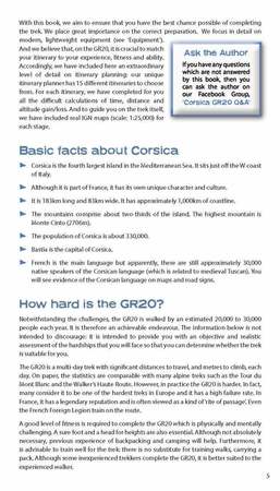
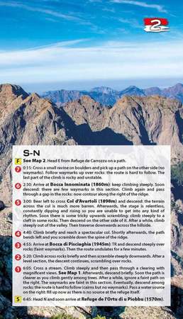
Jedyny dwukierunkowy przewodnik po GR20: zarówno trasy w kierunku północnym, jak i południowym są w pełni opisane.
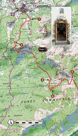
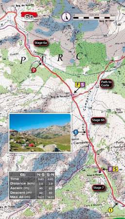
Zawiera prawdziwe mapy IGN (1:25 000): nie ma potrzeby noszenia oddzielnych map.
15 różnych tras: harmonogramy 9, 10, 11, 12, 13, 14, 15 i 16 dni. Obejmuje trasy w kierunku północnym i południowym . Wykonywane są za Ciebie trudne obliczenia czasu, odległości i przewyższenia.
Zawiera również:
- Szczegółowe informacje na temat wyposażenia i świateł drogowych
- Szczegółowe informacje o dotarciu do / ze wszystkich szlaków
- Wszystko, co trekker musi wiedzieć: trasa, koszty, trudność, pogoda, podróże i nie tylko
- Pełne oferty zakwaterowania: spektakularnie położone schroniska górskie i kempingi
- Informacje zarówno dla wędrowców z przewodnikiem, jak iz przewodnikiem
- Numerowane punkty trasy łączące Prawdziwe mapy z naszymi jasnymi opisami
- Informacje na temat dzikiej przyrody i roślin
The only two-way guide to the GR20: both northbound and southbound routes are described in full.
Real IGN Maps included (1:25,000): no need to carry separate maps.
15 different itineraries: schedules of 9, 10, 11, 12, 13, 14, 15 and 16 days. Includes both northbound and southbound itineraries. Difficult calculations of time, distance and altitude gain are done for you.
Also includes:
- Detailed information on equipment and travelling light
- Detailed information on getting to/from all trail-heads
- Everything the trekker needs to know: route, costs, difficulty, weather, travel, and more
- Full accommodation listings: spectacularly situated mountain huts and campsites
- Information for both self-guided and guided trekkers
- Numbered waypoints linking the Real Maps to our clear descriptions
- Information on Wildlife and Plants
| Autor: | Andrew McCluggage |
| Producent/Wydawnictwo: | Knife Edge Outdoor |
| Rok wydania: | 2020 |
| Kod kreskowy: | 9781912933051 |
| Skala mapy / planu miasta: | 1:25 000 (mapy wydanictwa IGN) |
| Język: | angielski |
| Ilość stron: | 172 |
| Wymiary: | 12,5 x 21 cm |
| Okładka / oprawa: | miękka |
| Numer wydania: | 1 |


