
690990688
geograf.biuro@gmail.comSzanowni klienci, w trakcie zakupów prosimy o zwrócenie uwagi na czas realizacji zamówienia poszczególnego produktu, znajdujący sie pod ceną produktu.
Kategorie
Producenci


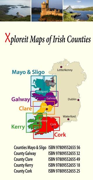
MAYO & SLIGO - IRLANDIA mapa turystyczna wodoodoporna XPLOREIT MAPS

| Producent: Xploreit Map IRLANDIA |
| Kod EAN: 9780955265556 |
")
Turystyczno samochodowa mapa wodoodporna irlandzkiego wydawnictwa kartograficznego Xploreit Maps
MAYO & SLIGO
w skali 1:100 000
Podział map na arkusze:
Mayo’s wealth of unspoiled, natural beauty is a fitting compliment to Sligo’s magnificent scenery providing a wonderfully varied landscape to be enjoyed by visitors. This map shows where all the famous landmarks and hidden gems are to be found when touring the area. A comprehensive compilation of waymarked trails with local walking loops , cycle routes, scenic drives, beaches, medieval buildings, megalithic sites, historic houses and numerous other points of interest are illustrated. Discover the haunts of W.B. Yeats like Lissadell, Drumcliff and Lough Gill along with dramatic vistas such as Croagh Patrick and the Doolough Valley using this easy to read sheet. Parts of Counties Galway, Roscommon, Leitrim and Donegal are also included. The scale of the Mayo & Sligo map is 1:100 000.

Walking Routes
The following long distance waymarked ways in Mayo and Sligo are included:
- The Western Way
- The Great Western Greenway
- The Foxford Way
- The Croagh Patrick Heritage Trail
Parts of the walking ways below are also shown:
- The Arigna Miner's Way
- The Suck Valley Way
An outline of the Bangor Trail through Ballycroy National Park is also shown. It is recommended that you call in to the Ballycroy Visitor centre and receive some guidance before attempting parts of this trail.
Over 20 National Loop Walks and other local walking trailheads are also illustrated.
Cycling Hubs, Loops and Routes
Four National Cycle Hubs are shown and their associated loops are mapped:
- Luisburg
- Westport
- Achill (Keel)
- Belmullet
Some of the Clidfen Cycle Hub loops are also shown.
Long Distance Cycle routes include:
- The Great Western Greenway
- The Tour De Humbert
- The Sheefry Route (Leenane to Westport)
- Part of the North West Trail
| Autor: | praca zbiorowa |
| Producent/Wydawnictwo: | XPLOREIT MAPS |
| Rok wydania: | 2013 |
| Kod kreskowy: | 9780955265556 |
| Skala mapy / planu miasta: | 1:100 000 |
| Język: | angielski |
| Ilość stron: | 2 |
-
Promocja PPolecany P

MALAGA plan miasta 1:10 000 MICHELIN
MALAGA plan miasta 1:10 000 MICHELIN42,90PLNStara cena 44,90Dodaj do koszykadodano produktprodukt niedostępny -
Promocja PPolecany P

EDYNBURG EDINBURGH plan miasta LONELY PLANET
EDYNBURG EDINBURGH mapa/ plan miasta PopOut Maps34,90PLNStara cena 39,90Dodaj do koszykadodano produktprodukt niedostępny -
Promocja P

BRISTOL mapa/ plan miasta PopOut Maps
BRISTOL mapa/ plan miasta PopOut Maps16,99PLNStara cena 19,99Dodaj do koszykadodano produktprodukt niedostępny -
Promocja PPolecany P

SZKOCJA ZACHODNIA I HEBRYDY mapa 1:250 000 Ordnance Survey
SZKOCJA ZACHODNIA I HEBRYDY mapa 1:250 000 Ordnance Survey44,90PLNStara cena 49,90Dodaj do koszykadodano produktprodukt niedostępny -
Promocja PPolecany P

WYSPA ŚWIĘTEJ HELENY mapa geograficzna 1:35 000 GIZIMAP
WYSPA ŚWIĘTEJ HELENY mapa geograficzna 1:35 000 GIZIMAP49,90PLNStara cena 59,90Dodaj do koszykadodano produktprodukt niedostępny -
Promocja PPolecany P

EDYNBURG mapa kieszonkowa 1:11 000 COLLINS 2020
EDYNBURG mapa kieszonkowa 1:11 000 COLLINS 202026,90PLNStara cena 29,90Dodaj do koszykadodano produktprodukt niedostępny -
Promocja PPolecany P

SZKOCJA SZETLANDY ORKANY mapa 1:250 000 ORDNANCE SURVEY 2020
SZKOCJA SZETLANDY ORKANY mapa 1:250 000 ORDNANCE SURVEY 202044,90PLNStara cena 49,90Dodaj do koszykadodano produktprodukt niedostępny -
Promocja PPolecany P

SZKOCJA PÓŁNOC I WYSPY mapa 1:300 000 ITMB 2020
SZKOCJA PÓŁNOC I WYSPY mapa 1:300 000 ITMB 202049,90PLNStara cena 59,90Dodaj do koszykadodano produktprodukt niedostępny -
Promocja PPolecany P

KORNWALIA mapa turystyczna 1:100 000 ORDNANCE SURVEY
KORNWALIA mapa turystyczna 1:100 000 ORDNANCE SURVEY44,90PLNStara cena 49,90Dodaj do koszykadodano produktprodukt niedostępny -

CAMBRIDGE mapa/ plan miasta PopOut Maps
16,99PLNDodaj do koszykadodano produktprodukt niedostępny -

OXFORD mapa/ plan miasta PopOut Maps
19,99PLNDodaj do koszykadodano produktprodukt niedostępny -
Promocja PPolecany P

SZKOCJA ŚRODKOWA I POŁUDNIOWA mapa 1:300 000 ITMB
SZKOCJA ŚRODKOWA I POŁUDNIOWA mapa 1:300 000 ITMB54,90PLNStara cena 59,90Dodaj do koszykadodano produktprodukt niedostępny -

ANGLIA POŁUDNIOWA I WALIA mapa samochodowa 1:300 000 MARCO POLO
22,90PLNDodaj do koszykadodano produktprodukt niedostępny -
.jpg "BATH mapa/ plan miasta PopOut Maps")
BATH mapa/ plan miasta PopOut Maps
BATH mapa/ plan miasta PopOut Maps16,99PLNDodaj do koszykadodano produktprodukt niedostępny -
Nowość N Promocja PPolecany P

EUROPA mapa 1:3 000 000 MICHELIN 2023
EUROPA mapa 1:3 000 000 MICHELIN 202324,90PLNStara cena 49,90Dodaj do koszykadodano produktprodukt niedostępny -
Promocja P

FALKLANDY mapa 1:365 000 Ocean Explorer Map
FALKLANDY mapa 1:365 000 Ocean Explorer Map69,90PLNStara cena 89,90Dodaj do koszykadodano produktprodukt niedostępny -
Nowość N Promocja PPolecany P

SZKOCJA 6 mapa 1:400 000 REISE KNOW HOW 2023
SZKOCJA 6 mapa 1:400 000 REISE KNOW HOW 202352,90PLNStara cena 59,90Dodaj do koszykadodano produktprodukt niedostępny -
Promocja PPolecany P

KORNWALIA CORNWALL mapa 1:150 000 FREYTAG & BERNDT
KORNWALIA CORNWALL mapa 1:150 000 FREYTAG & BERNDT49,90PLNStara cena 59,90Dodaj do koszykadodano produktprodukt niedostępny -
Nowość N

WIELKA BRYTANIA I IRLANDIA atlas samochodowy MICHELIN 2016
84,90PLNDodaj do koszykadodano produktprodukt niedostępny -
Nowość N Promocja PPolecany P

Cape Wrath Trail North XT40 mapa wodoodporna 1:40 000 HARVEY 2022
Cape Wrath Trail North XT40 mapa wodoodporna 1:40 000 HARVEY 202299,90PLNStara cena 124,90Dodaj do koszykadodano produktprodukt niedostępny -
Nowość N Promocja PPolecany P

Cape Wrath Trail South XT40 mapa wodoodporna 1:40 000 HARVEY 2022
Cape Wrath Trail South XT40 mapa wodoodporna 1:40 000 HARVEY 202299,90PLNStara cena 124,90Dodaj do koszykadodano produktprodukt niedostępny -
Promocja PPolecany P

EUROPA SZLAKI PIELGRZYMKOWE mapa 1:3 500 000 1:2 000 000 FREYTAG & BERNDT
EUROPA SZLAKI PIELGRZYMKOWE mapa 1:3 500 000 1:2 000 000 FREYTAG & BERNDT49,90PLNStara cena 59,90Dodaj do koszykadodano produktprodukt niedostępny -

IRLANDIA mapa samochodowa 1:300 000 MARCO POLO
23,90PLNDodaj do koszykadodano produktprodukt niedostępny -

LONDYN mapa/ plan miasta PopOut Map
19,99PLNDodaj do koszykadodano produktprodukt niedostępny -
Nowość N Promocja PPolecany P

SKYE TRAIL mapa wodoodporna 1:40 000 HARVEY 2023
SKYE TRAIL mapa wodoodporna 1:40 000 HARVEY 202396,90PLNStara cena 169,90Dodaj do koszykadodano produktprodukt niedostępny -
Promocja P

BELFAST plan miasta 1:12 000 Ordnance Survey
BELFAST plan miasta 1:12 000 Ordnance Survey49,90PLNStara cena 59,90Dodaj do koszykadodano produktprodukt niedostępny -
Promocja PPolecany P

WALIA I PD-ZACH ANGLIA 1:300 000 mapa ITMB
WALIA I PD-ZACH ANGLIA 1:300 000 mapa ITMB49,90PLNStara cena 59,90Dodaj do koszykadodano produktprodukt niedostępny -
Promocja P

CORK - IRLANDIA mapa turystyczna wodoodoporna XPLOREIT MAPS
CORK - IRLANDIA mapa turystyczna wodoodoporna XPLOREIT MAPS69,90PLNStara cena 84,90Dodaj do koszykadodano produktprodukt niedostępny -
Promocja PPolecany P

EDYNBURG I SZKOCJA POŁUDNIOWA mapa 1:10 000 / 370 000 ITMB
EDYNBURG I SZKOCJA POŁUDNIOWA mapa 1:10 000 / 370 000 ITMB54,90PLNStara cena 59,90Dodaj do koszykadodano produktprodukt niedostępny -
Promocja PPolecany P

ANGLIA POŁUDNIOWO - ZACHODNIA mapa 1:250 000 Ordnance Survey 2020
ANGLIA POŁUDNIOWO - ZACHODNIA mapa 1:250 000 Ordnance Survey 202044,90PLNStara cena 49,90Dodaj do koszykadodano produktprodukt niedostępny