
690990688
geograf.biuro@gmail.comSzanowni klienci, w trakcie zakupów prosimy o zwrócenie uwagi na czas realizacji zamówienia poszczególnego produktu, znajdujący sie pod ceną produktu.
Kategorie
Producenci

Dodano do przechowalni


PAPUA NOWA GWINEA mapa ITMB

PROMOCJA: 44,90 PLN
STARA CENA: 59,90 PLN
Czas wysyłki : 24 Godziny
| Producent: ITMB - International Travel Maps |
| Kod EAN: 9781553413424 |
")
")
")
")
Opis przedmiotu
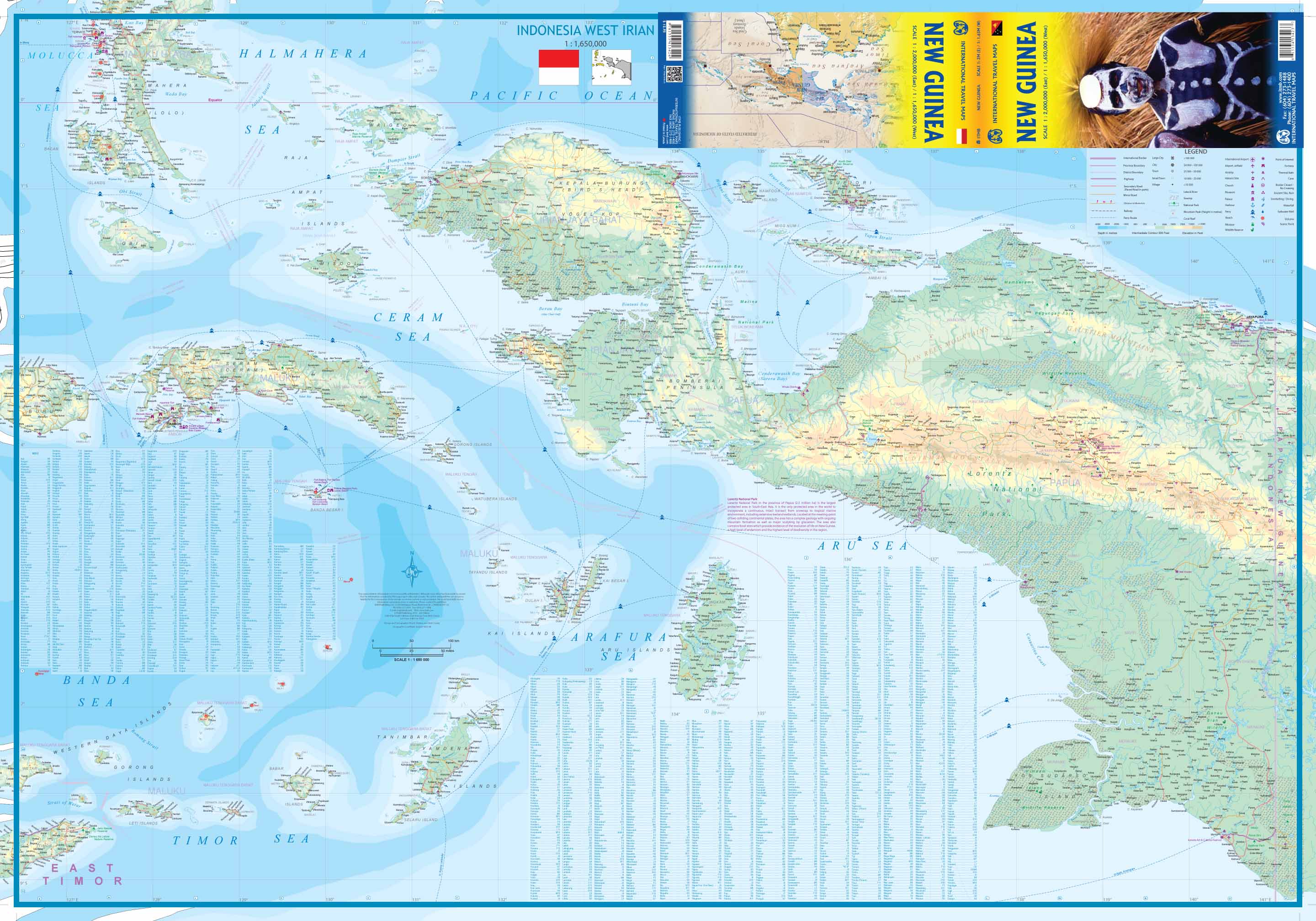
PAPUA NOWA GWINEA
Składana mapa w skali 1:2 000 000 / 1:1 650 000, kanadyjskiego wydawnictwa ITMB Publishing
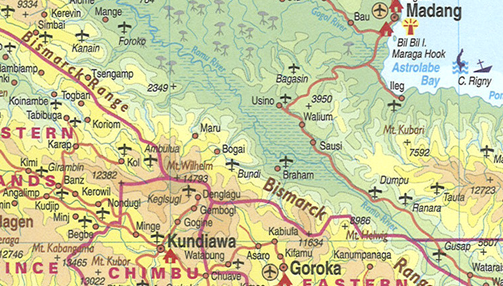
This is the replacement map for the former Papua New Guinea map. It has a similar cover picture, but for this edition, ITMB have added the rest of the island, the Indonesian province of West Irian, to the other side of the paper, creating a complete island map.
This map also includes some of the islands west of New Guinea, including the newly independent country of East Timor (not in great detail, but it’s there). Naturally, the Papua side has been updated cartographically, and is MUCH more developed than the western side, but the real significance of this title is that one of the largest islands in the world is now completely mapped for the first time ever.

This is the first new map of West Irian province for years, and adds interesting Indonesian islands from the Ceram Sea area, such as Anbom and Hatta to ITMB's detailed coverage of Indonesia.
The map shows the eastern half at 1:2 000 000 on one side and the western half on the other side at 1:1 650 000.
Specyfikacja
| Autor: | praca zbiorowa |
| Producent/Wydawnictwo: | ITMB |
| Rok wydania: | 2016 |
| Kod kreskowy: | 9781553413424 |
| Skala mapy / planu miasta: | 1:2 000 000 / 1:1 650 000 |
| Język: | angielski |
| Ilość stron: | 2 |
| Wymiary: | 10,5 x 25 cm |
| Okładka / oprawa: | miękka |
| Numer wydania: | 3 |
-
Promocja PPolecany P

South Pacific Cruising & Samoa mapa ITMB 2020
South Pacific Cruising & Samoa mapa ITMB 202054,90PLNStara cena 59,90Dodaj do koszykadodano produktprodukt niedostępny -
Nowość N Promocja PPolecany P

AUSTRALIA I OCEANIA mapa wodoodporna NATIONAL GEOGRAPHIC 2022
AUSTRALIA I OCEANIA mapa wodoodporna NATIONAL GEOGRAPHIC 202269,90PLNStara cena 79,90Dodaj do koszykadodano produktprodukt niedostępny -

785 AUSTRALIA mapa samochodowa 1:4 000 000 MICHELIN
39,90PLNDodaj do koszykadodano produktprodukt niedostępny -
Nowość N Promocja PPolecany P

ŚWIAT POLITYCZNY I FIZYCZNY mapa 1:20 000 000 FREYTAG & BERNDT 2023
ŚWIAT POLITYCZNY I FIZYCZNY mapa 1:20 000 000 FREYTAG & BERNDT 202354,90PLNStara cena 59,90Dodaj do koszykadodano produktprodukt niedostępny