690990688
geograf.biuro@gmail.comSzanowni klienci, w trakcie zakupów prosimy o zwrócenie uwagi na czas realizacji zamówienia poszczególnego produktu, znajdujący sie pod ceną produktu.
Kategorie
Producenci

Dodano do przechowalni


THE RED CENTTR Alice Springs to Uluru mapa 1:550 000 HEMA 2019

PROMOCJA: 44,90 PLN
STARA CENA: 59,90 PLN
Czas wysyłki : do 4 tygodni
| Producent: HEMA MAPS |
| Kod EAN: 9781925625745 |
Opis przedmiotu
The Red Centre Map - 7th Edition
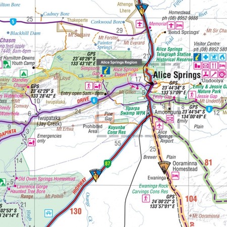
This regional waterproof map of the Red Centre is ideal for discovering the quintessentially Australian landscape of at the heat of the country. The main map covers the area around Alice Springs, including Uluru, Kata Tjuta, West MacDonnell Range and Watarrka National Park.
It also features additional information relating to permits, useful contacts and historical context surrounding some of the area's most popular tourist destinations.

PRODUCT FEATURES
- GPS surveyed roads and tracks
- Fuel stops
- 4WD tracks
- Camping areas
- Historic sites
- Detailed inset maps
WHAT'S NEW IN THIS EDITION:
- New edition, new layout
- New cartographic map specifications
Specyfikacja
| Autor: | PRACA ZBIOROWA |
| Producent/Wydawnictwo: | HEMA |
| Rok wydania: | 2019 |
| Kod kreskowy: | 9781925625745 |
| Skala mapy / planu miasta: | 1:550 000 |
| Język: | angielski |
| Ilość stron: | 2 |
| Wymiary: | 14 x 25 cm / 83,5 x 50 cm |
| Okładka / oprawa: | miękka |
| Numer wydania: | 7 |

